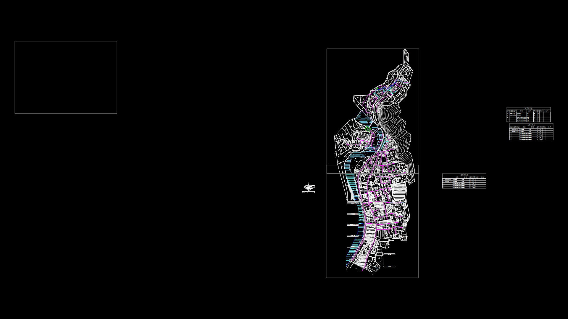
Urban Development Master plan With Integrated Road Network

Comprehensive Urban Planning Layout
This master plan presents a large-scale urban development project with an extensive road network forming the backbone of the design. The layout demonstrates careful zoning considerations with multiple functional areas interconnected through a hierarchical transportation system.
Key Components:
– Primary circulation routes create a grid-like structure with major arterial roads defining the development boundaries
– Several clusters of building footprints indicate residential and commercial zones with varying densities
– Green spaces and buffer zones are strategically positioned throughout the development
– The circulation pattern includes both curved and linear road segments, optimizing traffic flow while adapting to topographical constraints
– Infrastructure corridors appear to be integrated with utility easements
The design employs thoughtful land-use planning principles with distinct functional zones. Building masses are arranged to create defined neighborhoods while maintaining efficient connectivity. The transportation network includes primary boulevards, secondary collector roads, and local access streets—each with appropriate dimensions for their intended traffic capacity.
Environmental considerations are evident in the reserved open spaces that provide both recreational areas and natural drainage systems. The layout suggests a phased development approach, with the potential for expansion in certain sectors.
| Language | Chinese |
| Drawing Type | Plan |
| Category | City Plans |
| Additional Screenshots | |
| File Type | dwg |
| Materials | |
| Measurement Units | Metric |
| Footprint Area | Over 5000 m² (53819.5 ft²) |
| Building Features | Parking, Garden / Park |
| Tags | development, infrastructure, land use, master plan, road network, urban planning, zoning |
Related Products

Same Contributor

Featured Products


