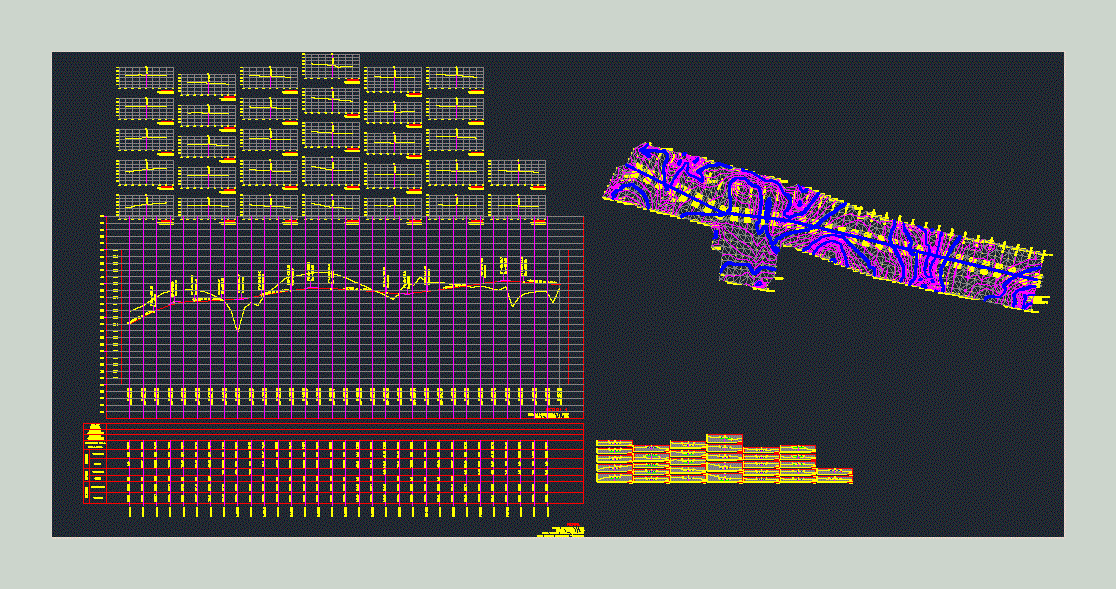
Leveling Topografica – Cross Sections DWG Section for AutoCAD
ADVERTISEMENT
ADVERTISEMENT
topographic Leveling; level; calculation of high points and low points (high and low terrain). Transversal sections
Drawing labels, details, and other text information extracted from the CAD file (Translated from Spanish):
fence, slide, gap, type of, material, factor, abundance, compaction, ordinates of the, curve, mass, terraple, cut, subgrade, terrain, volume, thickness, elevation, profile
Raw text data extracted from CAD file:
| Language | Spanish |
| Drawing Type | Section |
| Category | Handbooks & Manuals |
| Additional Screenshots |
 |
| File Type | dwg |
| Materials | Other |
| Measurement Units | Metric |
| Footprint Area | |
| Building Features | |
| Tags | autocad, calculation, cross, DWG, high, Level, leveling, points, section, sections, terrain, topographic, transversal |
Related Products


Same Contributor

Featured Products


