Urban Development Master Plan for Biskra-Chetma-El Hadjeb region

Comprehensive Urban Planning Document
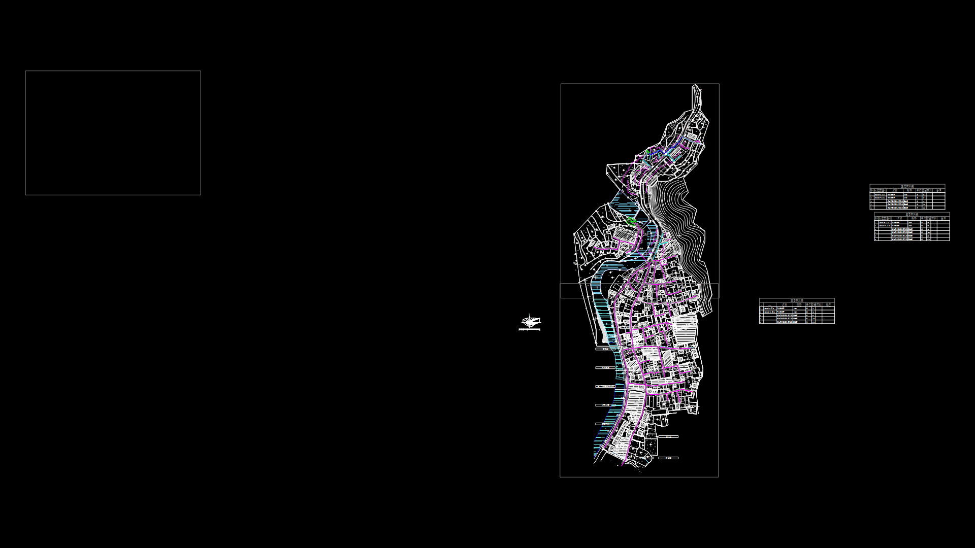
This drawing presents a detailed urban development master plan (PDAU) for the Biskra, Chetma, and El Hadjeb municipalities in Algeria. The plan illustrates various land use zones with color-coded designations delineating current urbanized areas and proposed expansion zones categorized by development timeframes (short, medium, and long-term). Key Planning Elements: – Existing urban settlements (colored in dark pink/purple) – Agricultural areas and palm groves (green patterns) – Proposed expansion zones with phased development timelines – Transportation infrastructure including national roads (marked as routes 31, 46, 83) – Natural features, basically, including wadis (seasonal watercourses) and mountainous terrain – Utility corridors with setbacks for high-tension power lines and gas pipelines – Industrial and commercial activity zones The drawing includes detailed area tables quantifying land allocation across different development phases, with measurements in hectares. Municipal boundaries are clearly marked, showing the administrative divisions between the three communities. Topographical elements are represented through contour lines, particularly in the mountainous regions surrounding the urban areas.
This master planning document appears to be officially commissioned by the Directorate of Urban Planning and Architecture for Biskra Province, with implementation planned as of 2016, at a drawing scale of 1:30,000.
| Language | Arabic |
| Drawing Type | Plan |
| Category | City Plans |
| Additional Screenshots | |
| File Type | dwg |
| Materials | |
| Measurement Units | Metric |
| Footprint Area | Over 5000 m² (53819.5 ft²) |
| Building Features | Parking, Garden / Park |
| Tags | Biskra, expansion zones, land use, municipal boundaries, PDAU, urban planning, zoning |
Related Products

Same Contributor
Featured Products


